(This is the promised English thread)
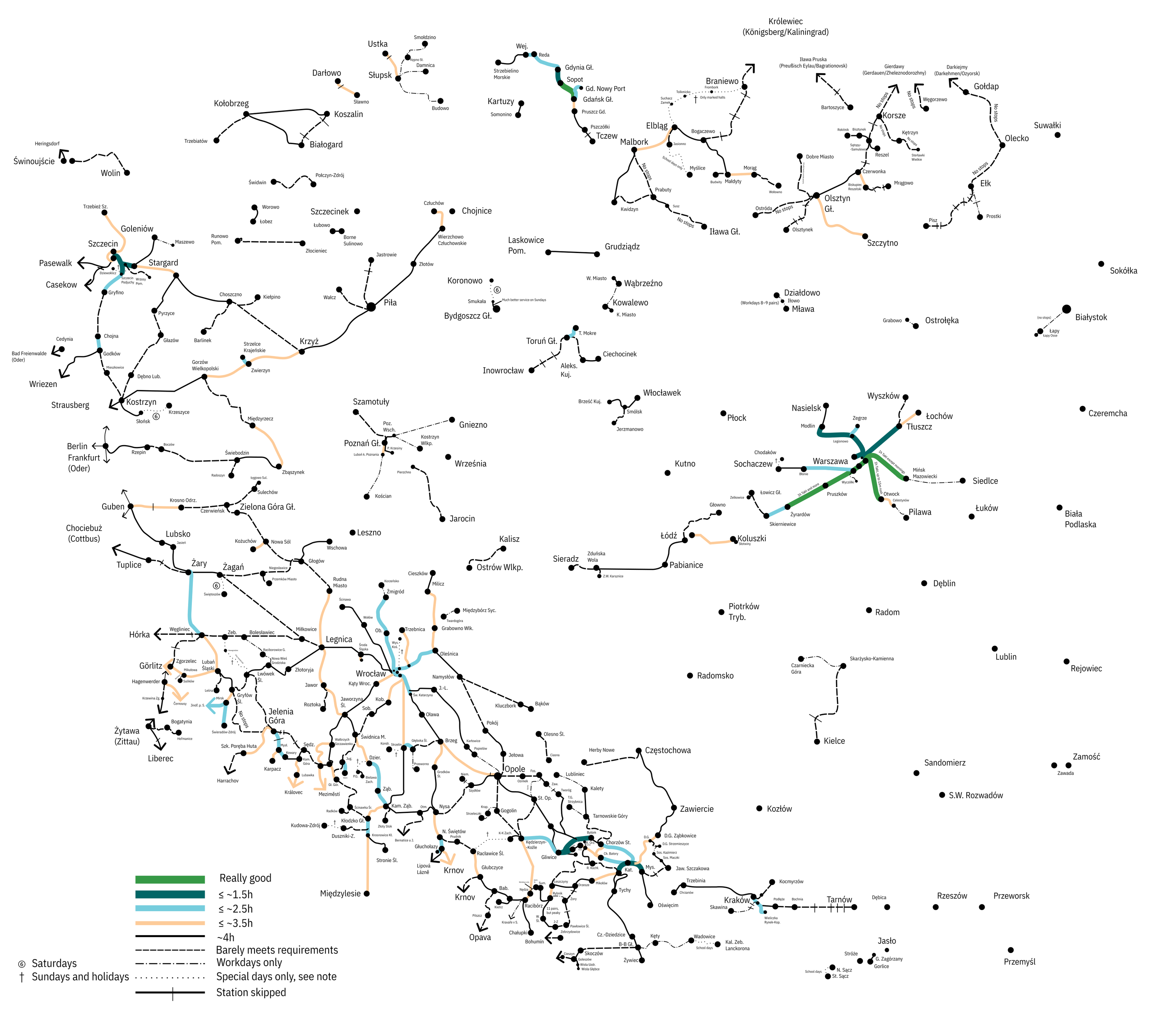
Here it is - the final (if kinda ugly, I'm no good at design) version of the #EffectivePaxRailNet Polish Lands 1939 map!
I drew it on paper and the digitized it with Inkscape, styling the lines with color and thickness to indicate the longest gaps between trains on the given sections. The dashed-not-dotted (slightly thicker) lines are generally ones with 6~6.5 pairs where my notes didn't clearly indicate the gaps were all smaller than 4h.
I used modern, or at least as modern as possible, Polish names everywhere (except for Kaliningrad Oblast, that place is complicated).
(And yeaaah, I really need to find somewhere I can host these things on a more permanent basis, especially including the original SVG - you can barely see the smallest captions due Mastodon image size limits)
(Post with rules I apply here: https://mastodon.com.pl/@HaTetsu/114558906905813832)
(I'd like to note that as I only looked at timetables of individual lines, you can't exactly judge the "effectiveness" of junction stations with this map, researching timed transfers is a whole 'nother thing)
1/n
(This thread is dedicated to @partim @tml and @jon (the former to for sparking the bout of inspiration that led to me actually doing this and the latter, because without him I wouldn't have been here to interact with the former two)
#rail #pkp#DeutscheReichsbahn #bahnbubble #trainbubble #history